River City Rain: Heavy Showers and Thunderstorms to Provide Much-Needed Drought Relief
Wet Friday Forecast for Northeast Florida
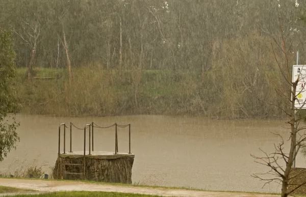
Residents of Jacksonville should keep their umbrellas and rain jackets close at hand today, Friday, February 27, 2026. The National Weather Service in Jacksonville has issued a forecast dominated by moderate to heavy showers and the potential for strong thunderstorms as a significant weather system moves through the region. While the rain may disrupt outdoor plans, meteorologists emphasize that this moisture is a welcome sight for a city currently grappling with extreme drought conditions.
Morning: A Damp Start with Rising Humidity
The morning hours will begin with a thick blanket of cloud cover and a noticeable rise in humidity. Low temperatures overnight hovered around 55°F, and as the morning progresses, light scattered showers are expected to become more frequent. Commuters should prepare for slick road conditions and reduced visibility during the early rush. By mid-morning, the atmosphere will become increasingly unstable, setting the stage for more intense activity later in the day.
Afternoon: Thunderstorm Risk and Peak Temperatures
Temperatures this afternoon are expected to climb to a high of approximately 69°F. The primary weather concern for the afternoon is the development of strong thunderstorms. According to the latest briefings, these storms are most likely to impact areas north of Interstate 10. While widespread severe weather is not currently predicted, any thunderstorms that develop could produce gusty winds and brief, intense downpours. Total rainfall amounts for the day are projected to range between 0.5 and 2 inches, with localized higher amounts possible in the most persistent storm cells.
Evening: Sustained Showers and Drought Relief
As evening approaches, the risk of isolated thunderstorms will diminish, giving way to more consistent, moderate rainfall that is expected to continue through the night and into Saturday. This period of sustained precipitation is being described by local experts as "beneficial rainfall." Jacksonville has been under a significant precipitation deficit, and today's system could provide the first meaningful relief in weeks, potentially reducing the intensity of the current extreme drought by next week.
Weather Safety and Planning
For those with outdoor activities planned for the remainder of the day, it is highly recommended to have a safe, indoor shelter in mind. The Jacksonville Fire and Rescue Department and the National Weather Service remind residents to avoid driving through standing water and to stay indoors if thunder is heard. Key forecast highlights include:
- Temperature Range: High of 69°F; Low of 55°F.
- Rainfall Totals: Expected accumulation of 0.5 to 2 inches.
- Primary Alert: Strong thunderstorms possible, particularly north of I-10.
- Drought Impact: Beneficial rain expected to alleviate local drought severity.