From Morning Showers to an Arctic Blast: Jacksonville Braces for a Sharp Sunday Swing
A Day of Drastic Transitions
Jacksonville residents are waking up to a weather pattern of two halves this Sunday, February 22, 2026. As a potent cold front moves through Northeast Florida, the region will experience a dramatic shift from lingering morning rain to a high-risk fire afternoon, followed by a bone-chilling Arctic blast by nightfall. The National Weather Service has issued several critical alerts that local residents should monitor throughout the day.
Morning: Rain Clearing and Mild Temperatures
The early morning hours will be dominated by the tail end of a cold front that moved in late Saturday night. Expect cloudy skies and scattered showers through the mid-morning hours, with total rainfall amounts estimated between 0.06 and 0.12 inches. Temperatures will start off relatively mild, reaching a daytime high of approximately 71°F. However, the wet weather will be short-lived; meteorologists predict the rain will move out of the Jacksonville area by noon, giving way to clearing skies and a rapid drop in humidity.
Afternoon: Red Flag Warning and Gusty Winds
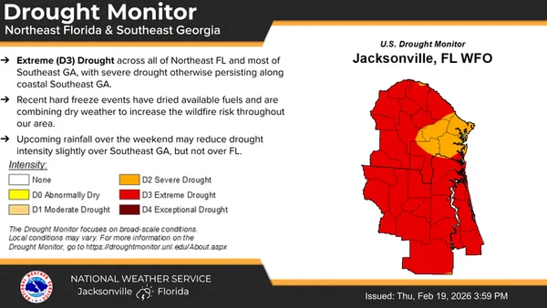
As the rain departs, the primary weather concern shifts from water to fire. A Red Flag Warning is in effect for Sunday afternoon and evening. Northwesterly winds are expected to intensify, with sustained speeds of 15 to 20 mph and gusts reaching between 25 and 35 mph. Combined with a plummeting relative humidity of roughly 25% and ongoing extreme drought conditions in Duval County, any outdoor fires could spread rapidly. Residents are strongly advised to avoid any outdoor burning and to exercise extreme caution with potential ignition sources.
Evening and Night: Freeze Warning and Arctic Air
The most significant change occurs after sunset as a surge of Arctic air sinks into the region. Temperatures will plummet rapidly from the afternoon highs into a projected overnight low of 45°F, with some inland areas seeing even lower figures. A Freeze Warning has been issued for portions of Northeast Florida starting tonight. The combination of gusty winds and falling temperatures will cause wind chill values to drop into the mid-to-upper 20s. Residents should prepare to protect sensitive plants, ensure pets have warm shelter, and check on neighbors who may be vulnerable to the sudden cold.
- Morning: Showers and clouds, high of 71°F.
- Afternoon: Clearing skies, wind gusts up to 35 mph, high fire danger.
- Evening: Temperatures dropping sharply, wind chills in the 20s.
- Night: Low of 45°F with a Freeze Warning in effect.